Saturday, December 11, 2021

Tour Suggestions Capetown + Western Cape

 Itinerary 


Day 1 

Cape Town to Groot Winterhoek

Spend half day day, walking etc 

SLEEP Langebaan 


Day 2

Westcoast Fossil Park 

Mussel Tour

Walk on beach 

SLEEP Langebaan 


 Day 3

Safari Day 

https://buffelsfontein.co.za/game-drives/ 

Beach walk 

SLEEP Langebaan 


 Day 4

Hemel-en-Aarde valley visit 

SLEEP Sandbaai


Day 5

Botanical Garden

Marine & Botany Experience with AndrΓ© 

SLEEP Sandbaai


Day 6

Drive to Cape Agulhas. Southern tip of Africa 

SLEEP L'Agulhas 


 Day 7

Drive to Knysna 

Visit Knysna heads

SLEEP Knysna 


 Day 8

Visit:

Tsitsikamma National Park 

Birds of Eden 

Monkeyland 

SLEEP Knysna


Day 9

Visit Swartberg Pass. 

Cango Caves

Sleep Oudtshoorn 


Day 10

Route 62  to Stellenbosch 


Day 11

Spend day in Stellenbosch/Franschhoek area 

SLEEP Stellenbosch area


Day 12

Drive back to Cape Town. 


Tour Suggestion 2

Day 1

Cape Town to Groot Winterhoek

Spend half day day, walking etc 

SLEEP Langebaan 


Day 2

Westcoast Fossil Park 

Mussel Tour (weather permitting) 

Walk on beach 

SLEEP Langebaan 


Day 3

Safari Day 

https://buffelsfontein.co.za/game-drives/ 

SLEEP Langebaan 


Day 4

Visit https://www.khwattu.org/

Drive via Clarence Rd to Sandbaai 

SLEEP Sandbaai


Day 5

Botanical Garden

Marine & Botany Experience with AndrΓ© 

SLEEP Sandbaai


Day 6

Hemel-en-Aarde valley visit 

SLEEP Sandbaai


Day 7

Drive to Cape Agulhas. Southern tip of Africa 

SLEEP L'Agulhas 


 Day 8

Drive to Knysna 

Visit Knysna heads

SLEEP Knysna 


Day 9

Visit:

Tsitsikamma National Park 

Birds of Eden 

Monkeyland 

SLEEP Knysna


 Day 10

Cango caves

Drive over Swartberg Pass. 

SLEEP Prince Albert


Day 11

Drive to to Stellenbosch. 

Afternoon in Stellenbosch/wine area

SLEEP Stellenbosch 


Day 12

Spend day in Stellenbosch/Franschhoek area 

Back to Capetown. 


Thursday, October 7, 2021

Silvermine Panorama/ Skyline Route

 Silvermine Panorama/ Skyline Route,  this circular route,  provides stunning views of both False Bay on the one side and Hout Bay on the other. 


The trail starts at the Silvermine Dam, at the end of the tarred road that leads in to the reserve, with the first part of the walk along the edge of the dam, before a short winding path leads off a jeep track to the plateaux above.  Eventually the path leads to the viewing platform at the top of Blackburn Ravine, with a much photographed view over Hout Bay.

The circular route branches off shortly before the platform, leading up to the ridge above. It is a walk of about an hour from here to the highest point at Noordhoek Peak. The views over the Atlantic coast are quite spectacular and include a designated viewing sight of the nesting place of a pair of black eagles (the nest can only be seen, not reached).
From Noordhoek Peak the path follows the jeep track for while before the path branches to Silvermine Ridge and back to the dam and car park. The hike takes about 3½ to 4 hours.


Sunday, October 3, 2021

Wood or also called Not-Woody Butress

Wood or also called Not-Woody Butress 


The Wood Buttress is on the Atlantic side. It is a thrilling route with a fair amount of moderately easy scrambling. In other words, climbing up rocks using both arms and feet.
The route is not very exposed. Above all, the rocks are made for climbing with plenty available hand- and foot holds. Therefore it is an ideal trail for those inexperienced in scrambling. If you do not want to scramble at all, Kasteelspoort is the trail for you.

The altitude at the start of this trail, is 330 m. Consequently, the elevation gain to the top of Wood Buttress is only 400 m, ending at 730 m. However, the top of Table Mountain, at the Cableway, will take you to 1060 

Only a few know the route over the Wood Buttress. Therefore you are likely to walk alone and really experience nature.

It takes +/-3 hours to hike to the top of Wood Buttress at a comfortable pace, including photo stops and rest stops. The size of the group as well as fitness levels will largely determine the duration. During the hike, stop at the Old Cableway, with the iconic sufboard rock in the background.

The descent
Descend the mountain either by Kasteelspoort or Woody Ravine, which add +/-2 more hours to the hike.

Reason to choose this hike:
If you enjoy scrambling, are reasonably fit and wants an exciting, beautiful hike. You must have no fear of heights! Fear will not only prevent you from having fun, but it will also put you in danger, as a large part of this trail involves scrambling.


Friday, October 1, 2021

Marloth Hiking Trail

 Marloth 


The Swellendam Hiking Trail is often compared to the Otter in terms of difficulty – hikers must have suitable experience. All food and cooking gear must be carried with. There’s plenty of clean water en route, and each hut is close to a perennial stream.

Day 1’s hike is long, so aim to arrive at the office early. 

It’s possible to reach every hut by lunchtime (except for Day 1) if you start early.

Day 1: Office to Boskloof Hut – 15km/7 hours

After signing in,  cars can be parked behind locked gate. Try get a lift with a park officer to the start at Duiwelsbos (you might have to hike in the 2km to the start). The trail jumps right into the action with a steep zig-zag climb through the fynbos – a long day awaits, so take it easy and conserve your energy.

About halfway the trail swings North and heads over the mountain, with the majestic Boskloof gorge dropping down on the right-hand side. Numerous small streams, use each opportunity to fill up. After a sting-in-the-tail final uphill it relax at Boskloof hut, take a refreshing dip in the nearby rock pool and enjoy peace and quiet.

The original wooden Boskloof hut burned down some years ago, and has been replaced with 2 spartan sheet metal huts. 


Day 2: Boskloof Hut to Goedgeloof Hut – 12km/5.5 hours

The trail starts with an uphill. It then crosses into a wide valley, where it follows the Langkuile river upstream. This part of the route is fairly flat.

Soon the Goedgeloofnek will be reached that looks down the other side of the mountains to the Robertson Valley. Only (steep) downhill from here! Far below, the Goedgeloof hut complex will be visible, count on just more than an hour’s descent to the hut from the Nek.

Compared to Boskloof, Goedgeloof is luxurious. There are two dormitory buildings with bunk beds and mattresses, eco toilets, a cool stream nearby, and a great communal kitchen with a picnic table and stoep to admire the sunset. The hut is on private property and swimming is prohibited at the nearby dam.


Day 3: Goedgeloof Hut to Proteavallei Hut – 10km/5 hours

This is one of the easiest days.  The path ambles along before a stiff climb up to Warmwaternek around the 3km mark, with an elevation gain of 500m. Take it slowly and steadily – after this initial climb, the rest of the day is a breeze. 

From here the trail winds along the Protea Valley to its namesake hut. En route, the so-called “Clock Peaks” and the imposing 1710m Misty Point (often true to its name) stand guard over a breath-taking landscape that teems with proteas!

The hut is a wooden beauty with a large covered stoep, two dormitories with bunk beds and mattresses, and long drop outhouses some distance away. 

Day 4: Proteavallei Hut to Wolfkloof Hut – 7km/4 hours

The trail, aptly named the “Kruispad”, crosses over again to the Swellendam side of the mountain. 

After the usual uphill (gains 200m) there is a view over the farmland and faraway Indian Ocean. Descend into Kleinhoutboskloof, where the path precariously hugs the mountainside as it descends. It’s not too technical, but take care with the loose terrain!

The bottom part of the trail is an easy cruise down to the Wolfkloof gorge – look out for King Proteas on the way. Nestled down by the river is the final wooden hut, with a separate basic lapa and fireplace.

The river close by,  has several large pools to explore and swim in. The hut has a lovely big grass lawn in front. Amenity-wise, there are bunk beds and mattresses, a basic long drop outhouse and a cold-water shower. 

Day 5: Wolfkloof Hut to Office – 10km/5 hours

The last day has a rather sneaky climb up and out of Wolfkloof to the next gorge, Hermitagekloof. There’s a small ravine here with a rock pool and lovely shade for a quick brunch.

The trail then quickly descends into pine plantation (this is about the halfway mark for Day 5). Another quick switchback climb then lead out onto a wide jeeptrack that meandered back to the office. 60km done and dusted!.

 You can grab a shower close to the office building complex. 

It is a challenging, but an amazing hike. 

πŸ‘£πŸ‘£πŸ‘£

Wednesday, September 1, 2021

International Cuisine

International Cuisine 

Willoughby & Co in the Waterfront . Excellent fusion style Japanese cuisine

A full Japanese culinary experience.Head Asian chef, Sam, and his dedicated team have continues to create new and exciting dishes.

Saigon in Cape Town offers magnificent views of Table Mountain, the Vietnamese decor is done elegantly without giving the restaurant a themed feeling.

The menu is mainly Vietnamese with Japanese influences. We ordered Pho Bo Soup, Yaki Gyauza, Spinach Dumplings, cauliflower pops, chichen skewer and more. Al the dishes were delicious .  


More to follow soonπŸ₯˜πŸ²πŸ₯£πŸ₯—πŸ±


Friday, August 6, 2021

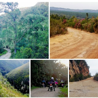
Motorbike dirt roads Karoo

Motorbike trip to the Great Karoo on dirt roads. Magnificent! 


Day 1. Somerset-wes to Barrydale. Motorbike trip to the Great Karoo on dirt roads. Magnificent! I was priveleged to be part of the support team. 
🏍️🏍️🏍️🏍️🏍️🏍️🏍️🏍️🏍️🏍️🏍️🏍️🏍️

Day 2. Barrydale via Swartberg Pass to Prince Albert


The 27km Swartberg Pass is considered one of the finest mountain passes in the world: an untarred road that winds to the summit 1583 metres above sea level in steep zigzags and sudden switchbacks with breathtaking views at every turn. The road is supported in places by hand-packed stone walls, a trademark of brilliant road engineer Thomas Charles Bain. Declared a national monument in its centenary year, 1988.

🏍️🏍️🏍️🏍️🏍️🏍️🏍️🏍️🏍️🏍️🏍️🏍️🏍️

Day 3. Prince Albert via Meiringspoort to Willomore

Meiringspoort towering sandstone cliff walls and breathtaking rock formations  has jaw-dropping beauty as it winds its way through the Swartberg Mountains. The Poort follows the natural gorge hewn by the Groot Rivier (big river) through the Swartberg range connecting, on either end, the towns of Klaarstroom and De Rust, or the Groot and Klein Karoo respectively.

🏍️🏍️🏍️🏍️🏍️🏍️🏍️🏍️🏍️🏍️🏍️🏍️🏍️

Day 4. Willomore to Bucklands Guest Farm


🏍️🏍️🏍️🏍️🏍️🏍️🏍️🏍️🏍️🏍️🏍️🏍️

Day 5.  Bucklands Guest Farm via Antoniespass to Patensie.


Antoniesberg Pass, the locals refer to it as the Grootrivier Poort Road, is a remote, gravel Pass that crosses over the Grootrivier on the northern side of the Baviaanskloof Mountain in the Eastern Cape. This Pass is no Sunday drive and not for the faint hearted but magnificent scenery and a great adventure! 
🏍️🏍️🏍️🏍️🏍️🏍️🏍️🏍️🏍️🏍️🏍️🏍️🏍️

Day 6. Through the Baviaanskloof


The Baviaanskloof Region in the Eastern Cape, a land of raw wilderness with its rocky passes and rugged gorges, has recently been awarded World Heritage Site status. The gorge stretches for over 100 kilometres in the valley between the Baviaanskloof Mountains to the north and the Kouga mountains to the south. 

This 192 000 hectare u-shaped reserve can only be travelled from east to west or from west to east. The pass was built between 1880 and 1890 by Thomas Bain. The single dirt road winds its way through the valley with no other access, in or out. 

It is named after the baboons that roam the area - a mix of the Dutch word ‘baviaan’ for baboon and the Afrikaans word ‘kloof’ for ravine.

Baviaanskloof offers hours of beautiful scenery - veld, indigenous forests, crystal mountain streams, sheer cliffs and waterfalls, and is home to an amazing diversity of plants and species - from yellowwoods to karoo bossies and Fynbos.
🏍️🏍️🏍️🏍️🏍️🏍️🏍️🏍️🏍️🏍️🏍️🏍️🏍️

Day 7 Baviaans via Prince Alfred Pass to Diepwalle, Knysna 


The beautiful Prince Alfred's Pass is on the R339 gravel road between Knysna and Uniondale, also known for the Karoo-to-coast cycle race. 

The pass is Thomas Bain's Opus Magnum - a work of monumental proportions carried out with rudimentary equipment and convict labour, but with science, ingenuity and Bain's "can do" attitude making it all possible. Bain constructed 29 passes mainly in the Cape colony in his lifetime. This pass epitomises all of his unique touches, but especially his exceptional dry walling method of construction.

The pass is probably Thomas Bain's greatest work. Not only was this an extremely long pass, but it also presented almost every possible technical obstacle to the pass-builders. At 68,5 km it is the longest (publicly accessible) mountain pass in South Africa by a considerable margin, as well as being the second oldest unaltered pass still in use.   

🏍️🏍️🏍️🏍️🏍️🏍️🏍️🏍️🏍️🏍️🏍️🏍️🏍️

Day 8. Camp in the indigenous Forest at Diepwalle. Walk elephant trail. Visit Big Tree. 


Camping in the Knysna Forest in the Diepwalle indigenous Forest area is great. There are wooden decks that can accommodate a three man tent. Ample beautiful hike trails.

🏍️🏍️🏍️🏍️🏍️🏍️🏍️🏍️🏍️🏍️🏍️🏍️🏍️

Day 9: Diepwalle onwards via Kom se Pad 


Kom se Pad, a beautiful drive through the lush indigenous forests of the mountains north of Knysna, winds its way between Diepwalle in the east Gouna in the west. This is one of the best publicly accessible roads in deep indigenous forests where one doesn't require to be in a 4WD vehicle.

🏍️🏍️🏍️🏍️🏍️🏍️🏍️🏍️🏍️🏍️🏍️🏍️🏍️

Day 10: Seven Passes Road to George. 


Seven Passes Road is the oldest direct road link between George and Knysna. The road which traverses seven passes was engineered by Thomas Charles John Bain and Adam de Smidt. It was completed around 1883 and is situated just south of the Outeniqua Mountains.

This 75 km historic road was completed in 1883. Rivers generally flow in deep gorges on their way from the mountains to the sea, therefore there are seven passes along the way, hence the name of the route. These are the passes crossing the Swart-, Kaaimans- and Silver-, Touw-, Hoogekraal- and Karatara rivers, the Homtini gorge and the Phantom pass.

🏍️🏍️🏍️🏍️🏍️🏍️🏍️🏍️🏍️🏍️🏍️🏍️🏍️


Sunday, June 6, 2021

Orange River Rafting/Canoeing

Orange River Rafting/Canoeing

The Orange River Trails River Camp is approximately 700 kilometres from Cape Town, halfway between Cape Town and Windhoek, Namibia’s capital city. It is situated on the northern banks of the Orange River, close to the town and border post of Noordoewer in the Karas region of Namibia. This region boasts many attractions, such as the rugged Richtersveld landscape, the Fish River Canyon and Ai-Ais hot water springs, the picturesque town of Luderitz with its nearby ghost town of Kolmanskoppe and the Quiver Tree Forest and Giant’s Playground near Keetmanshoop. Activities in the area include canoeing and river rafting on the Orange River, walking the 5-day Fish River canyon hike and dune driving at Luderitz.

This wilderness experience is a complete breakaway from frenetic urban lifestyles. Paddling between the beautiful rock formations of the Richtersveld where quiet stretches of the Orange River contrast exhilarating rapids, is food for the soul. These fun-filled trips are family-friendly and suitable for people of all ages!

The team have been guiding for many years and will guide you safely down the river while you take in the fun and experience of your Orange River Rafting adventure. They will also cook delicious and wholesome meals for you while you relax and soak up the Tranquillity of the area.


Monday, May 10, 2021

Constantia Green Belts

Constantia Green Belts & Tokai

The Constantia Green Belts occupy a couple of areas throughout this leafy suburb. There are a number of beautiful trails where you can walk. 


Routes

De Hel Nature Area
Easy

Park at the entry on Constantia Nek Road, look out for the small parking area on the left side of the road if you’re coming from Rhodes Drive. There’s another parking lot on Southern Cross Drive and the route is semi-circular so you can start at either entrance. There’s a clear path around the valley with smaller paths leading down to the streams that run through it. 

A dell of overgrown Fynbos and invading forest under pines, with superb flat walks and steep alternatives). When there was more Fynbos, this area was renowned for its Knysna Scrub Warblers, but is now overgrown and is unlikely to be regularly burned (approximately every 10 years) to maintain the Fynbos because of the houses upslope. 

Duration: The circular route will take just under an hour, but spend some time following the paths and exploring.


Alphen Trail
Easy
Park on Alphen Driveoff of Constantia Main Road and set off along the path next to the Diep River. There are a couple of bridge crossings where you can choose to walk on the other side. This isn’t a circular route and you can also start the walk on the other end and park on Le Sueur Avenue.

Alphen Hotel west to Le Sueur Meadow, along Diep River. More details under Easy day hikes. 

Duration: Approximately 1 hour return


Brommersvlei Walk
Easy
Park on Rathfelder Avenue or BrommersvleiRoad, this tree lined trail leads alongside the road before circling the Bel Ombre Meadow.

Duration: This walk will take half an hour or so.

Diep River Trail
Easy
This route can link up to the Alphen Trail, the Brommersvlei Walk and the Klaasenbosch Trail. Park on Le Sueur Avenue or Southern Cross Drive. The route takes you along this green belt and you can then continue on along one of the other three routes or retrace your steps. Lovely shaded walk

Le Sueur Meadow west to Cecilia Forest at Southern Cross Drive

Duration: This will take over half an hour.


Doordrift Walk

Easy
This starts in the same place as the Alphen Trail but the walk goes in the other direction, or you can park on Doordrift Road and do the route the other way round.

Doordrift Rd Plumstead northwest to Alphen Hotel, along Diep River, and over the detention ponds. 

Duration: 25-30 minutes


Grootboschkloof Trail
Easy
Park on Strawberry Lane, Spaanschemat River Road or Willow Road and follow the path along the river. This isn’t a circular route and you can link up to the Spaanschemat River Trail if you want a longer walk.

From Firgrove Way north to Spaanschemat Road along the Grootbos River. 

Duration: Twenty-five minutes or so.


Klaasenbosch Trail
Easy
There are several parking areas along this trail with the top two being off Rhodes Drive near the Kirstenbosch top gate and at Cecelia Forest. The bottom two can be found at Le Sueur Avenue or Hohenort Avenue. The middle of the walk passes by the Cellars-Hohenort Hotel. 

Le Suer Meadow north along Klaasenbosch River to Klaasenbosch – Kirstenbosch Rycroft Gate. Lovely shaded walk, with a planted “indigenous” section wherein some of the plants are named (i.e. indigenous to South Africa, not the Peninsula)

Duration: Just under an hour.


Silverhurst Trail 
Easy
You can park across the road from Peddlar’s on the Bend on Spaaschemat River Road or at the other end of the trail on Constantia Nek Road. After a five-minute walk from Peddlers across Constantia Main Road to Silverhurst. 

Duration: This will take about forty minutes.

Spaanschemat River Trail
Easy
This trail starts out from the same parking area as the Silverhurst Trail on Spaaschemat River Road but goes off in the other direction. You can also park on Strawberry Lane at two different locations. You can link up to the Grootboschkloof Trail at the far end from the Spaaschemat start. 

From Firgrove Way west to Spaanschemat River Road at Peddlers along the Spaanschemat River)

Duration: It’ll take about thirty five minutes.


Keysers River Trail
Easy
From Firgrove Way south along the Keysers River to the Cycle Track – and Tokai Park – and Tokai Lismore avenue. 

This trail links, by way of Tokai Park, to Tokai Manor, the Arboretum and the Elephants Eye Path, and via the Constantiaberg contour path to Constantia Nek, Cecilia and to Kirstenbosch – for those wanting more strenuous hikes or cycles. 

Duration: 30-35 minutes 

Lower Tokai Forest

There are several paths through the Fynbos at Lower Tokai Park, and a perimeter walk (Bridle Path) which is mostly shaded. Do watch out when walking under the Gum trees, which are known to shed their branches.

The paths through the Fynbos are called: Candelabra, Kalkoentjie, Fountainbush, Brightfig and Silkypuff – after some of the beautiful Cape Flats Sand Fynbos species.

Walking from the Tokai Restoration Trail (which starts at the Lions Gate carpark) along the Brightfig trail to the Silkypuff trail will take you to The Mound where there is a viewing deck which affords beautiful views of the park.

The Main Drag is a sandy path which currently divides the plantation (roughly) from the Fynbos at Lower Tokai Park.

A beautiful river – which is also undergoing rehabilitation – runs along the Main Drag, and the best time to see this in full flow is towards the middle or end of winter (July/August)


Tuesday, May 4, 2021

The Cederberg mountains

 The Cederberg mountains

The Cederberg mountains  located near Clanwilliam are . The mountain range is named after the endangered Clanwilliam cedar, which is a tree endemic to the area. 

Most of the Cedarberg mountains are part of the official Cederberg Wilderness Reserve and remain one of the most pristine areas of South Africa. 

The Cederberg is famous for its spectacular rock formations that were sculpted by wind and water over many millions of years. Almost the entire area consists of sedimentary rock, sandstone and shale.  The distinct reddish colour of rock is a result of minerals like iron and manganese that formed part of the sediments. Pristine Fynbos grows here includung various types of Restios and the snow Proteas. 


The solitude and breathtaking natural beauty of the area is captivating.  A true wilderness experience with dramatic sunsets!


Various wonderful hiking trails to choose from. 


Tuesday, March 23, 2021

1 Day Hiking Trails close to Capetown

Groot Winterhoek

The beautiful Groot Winterhoek is known for its rugged, wild landscape & "Rock formations. 

Die Hel is nestled in the Groot Winterhoek mountains which is one of the largest rock pools in the Western Cape, a secluded piece of paradise.

Hiking to the peak is tough but absolutely incredible. Best to plan to sleep over somewhere on the route (Wilderness permit). It so beautiful and very little people will manage to reach the peak and come down in one day. 


Haarkapper Hiking Trail 

The Haarkapper Hiking Trail offers you a chance to walk in the footsteps of the famous Tesselaarsdal Barber crossing the Klein River Mountains between Phillipskop near Stanford and Tesselaarsdal. The route can be walked starting from either side and can be done as a figure of eight starting and finishing at the same point, or just one way if you have transport arranged on the other side. 

Jannie Willemse was a farmer from Tesselaarsdal who used to walk 20km over the Klein River Mountains to Stanford every Saturday, to cut the townsfolk’s hair, before returning to his Tesselaarsdal farm the same day. He did this each and every Saturday for over 20 years without fail, clocking up more than 42,000km on foot, faithfully serving his Stanford custom on foot – more than the distance all the way around the earth!


South Africa Tour

South Africa Tour Day 1 to 47

South Africa Tour I will go on a virtual tour through beautiful South Africa during lockdown 2020...