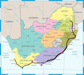
This is the place where you can put your one foot in the warmer Indian Ocean and the other in the cold Atlantic Ocean – at the same time.
Although there is a lot of debate around it, this is technically the dividing line along the meridian of 20⁰ East to Cape Agulhas where the oceans meet kilometres into the ocean. a
Early Portuguese seafarers rounding this dangerous point called it L'Agulhas which means Cape of Needles (referring to the jagged rocks of the coastline and also the fact that a compass shows no real deviation between true north and magnetic north at this spot).
The beautiful, historic red and white lighthouse is the second oldest working lighthouse in South Africa It is definitely worth climbing the 71 wooden steps leading to the top to enjoy the stunning views over the area.
West of the lighthouse is the entrance to the Agulhas National Park boasting 2000 species of indigenous plants in its 20 000 ha area. Do yourself a favor and hike one of the many picturesque trails amongst the Fynbos.
The Cape Agulhas Region is mostly a dairy, wool and wheat farming area, but having the Atlantic and Indian Oceans around it, fishing has been an important industry since the early days.
Tag 16 unserer virtuellen Tour und wir besuchen die südlichste Spitze Afrikas am Kap Agulhas (südlichste Stadt Afrikas)
Dies ist der Ort, an dem Sie Ihren einen Fuß gleichzeitig in den wärmeren Indischen Ozean und den anderen in den kalten Atlantik setzen können.
Obwohl es viele Debatten gibt, ist dies technisch gesehen die Trennlinie entlang des Meridians von 20 ° Ost zum Kap Agulhas, wo sich die Ozeane kilometerweit in den Ozean treffen. ein
Frühe portugiesische Seefahrer, die diesen gefährlichen Punkt umrundeten, nannten ihn L'Agulhas, was Kap der Nadeln bedeutet (bezogen auf die gezackten Felsen der Küste und auch auf die Tatsache, dass ein Kompass an dieser Stelle keine wirkliche Abweichung zwischen dem wahren Norden und dem magnetischen Norden zeigt).
Der schöne, historische rot-weiße Leuchtturm ist der zweitälteste funktionierende Leuchtturm in Südafrika. Es lohnt sich auf jeden Fall, die 71 Holzstufen zu erklimmen, die nach oben führen, um den atemberaubenden Blick über die Gegend zu genießen.
Westlich des Leuchtturms befindet sich der Eingang zum Agulhas-Nationalpark mit 2000 einheimischen Pflanzenarten auf einer Fläche von 20 000 ha. Tun Sie sich selbst einen Gefallen und wandern Sie auf einem der vielen malerischen Wanderwege zwischen den Fynbos.
Die Region Cape Agulhas ist hauptsächlich ein Milch-, Woll- und Weizenanbaugebiet, aber mit dem Atlantik und dem Indischen Ozean ist die Fischerei seit den Anfängen ein wichtiger Wirtschaftszweig


No comments:
Post a Comment